The Berlin City Map
Always know where you’re going
 Event
Event
 Attraction
 Ticket
 Hotel
Hotel
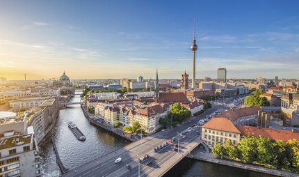
How do I get from the main railway station to my hotel? How far is Alexanderplatz from the Brandenburg Gate? Where are the Ku'damm and the Gedächtniskirche? Whether on foot, by bus or train - the street map of Berlin makes it easier for you to find your way around the city centre. You can get the foldable city map for just 1 euro at our Berlin Tourist Info, where our friendly staff will also provide you with personal, comprehensive and multilingual advice on excursions, tickets and other questions.
The Berlin city map contains:
- Map of Berlin city centre
- Line network of Berlin public transport (S-Bahn, U-Bahn, bus, tram)
- Pictograms of centrally located sights
- Addresses of Berlin Tourist Info
- Former course of the Berlin Wall
Sustainability
The city maps are printed on FSC Mix certified paper. This means that the paper is made from 100% recycled paper and paper from legal wood sources.
Our tip: The city map doesn't have to be thrown away after your holiday. Keep it as a souvenir, use it as a background for a photo collage or mark all the places you visited in Berlin and the hotel you stayed in. A few creases will only make the souvenir more authentic.
You can purchase the city map here
Our Tourist Info Centers
Berlin Brandenburg WelcomeCenter
Flughafen Berlin Brandenburg, 12529 Schönefeld Learn more To the route plannerBerlin Tourist Info Centre at Brandenburg Gate
Pariser Platz, südliches Torhaus, 10117 Berlin Learn more To the route plannerBerlin Tourist Info Center at Humboldt Forum
Schloßplatz, 10178 Berlin Learn more To the route plannerBerlin Tourist Info Centre at the Berlin Central Station
Erdgeschoss/ Eingang Europaplatz, 10557 Berlin Learn more To the route plannerTitle
Our apps will also help you find your way around the city and discover exciting places: ABOUT BERLIN and Going Local Map.


